AIS
Book Extract
(Automatic Identification System)
Description
The automatic identification system, AIS, is an anti-collision aid for ships imlemented by the UN’s International Maritime Organization (IMO) to improve safety at sea, but is also being used more and more by fishing and cruising boats.
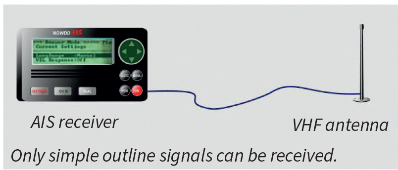
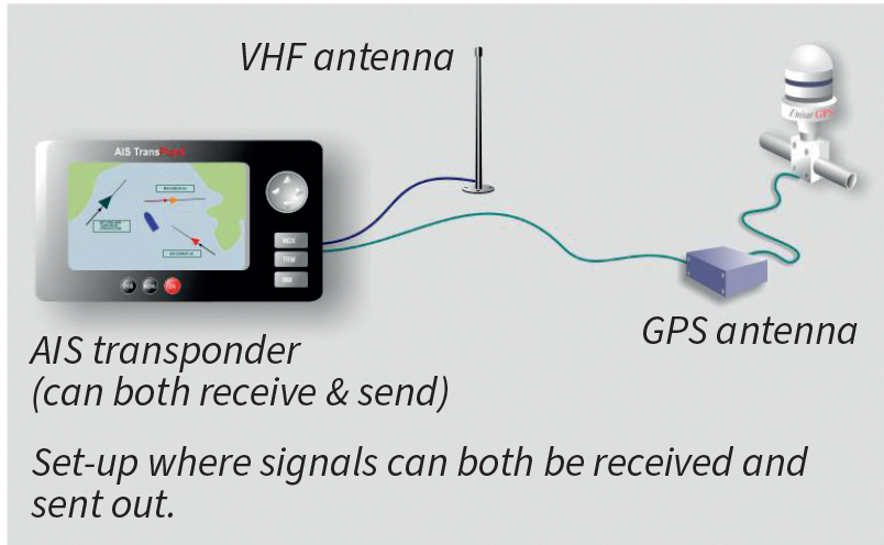
Cruising yachts will often settle for an AIS receiver. But AIS transmitters meant for pleasure boats are also available, so-called Class B transponders. These are for those who not only want to see the ship traffic, but also be seen themselves. Anyone having AIS installed will then see your boat on the screen and thus increase safety considerably.
These transponders are, of course, more expensive, but will probably be found on more and more small boats. An AIS, with GPS and VHF antenna connected to a chart plotter or radar, can send and receive signals, as well as get graphics and data on the respective screens.
Vessels that have AIS equipment onboard send / receive data automatically: identity (boat name, size, type of boat, etc.), position, course, speed, etc., over the VHF band to all boats with AIS receivers within VHF range.
AIS is also used by maritime traffic controllers to keep track of shipping traffic in their areas.
The range of AIS varies. It can be up to well over 40M. IMO requires all vessels over 300 gross tons to be equipped with AIS transponders. Most ships have AIS (with some exceptions).
When you hover your mouse over a vessel on the map, you get a small pop-up window with the vessel name, etc. Clicking on the vessel shows you more information in a larger panel such as CPA (see p.57) and TCPA (time to closest point of approach). All the vessels that can receive data from AIS are shown, meaning that, with a single click, you can get information about any of these vessels.
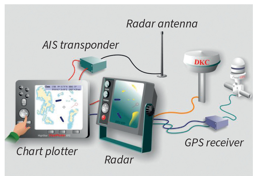
Advanced set-up where signals can both be received and sent and additionally displayed on radar and chart.
The vessels will often appear as circles with course line and speed indicator in blue. On larger scale maps or zoomed in large vessels can be shown graphically as figures in relative size. When at risk of collision (depending on your set-up), the vessel colour often changes to red.
© Not to be reproduced without written permission from Fernhurst Books Limited.