PREDICTING GUSTS
Gusts are generally caused by parcels of air above the boundary layer, which are travelling at the geostrophic wind velocity, being entrained into the boundary layer randomly. They keep their momentum from the geostrophic wind and, if they reach the surface, we feel them as gusts.
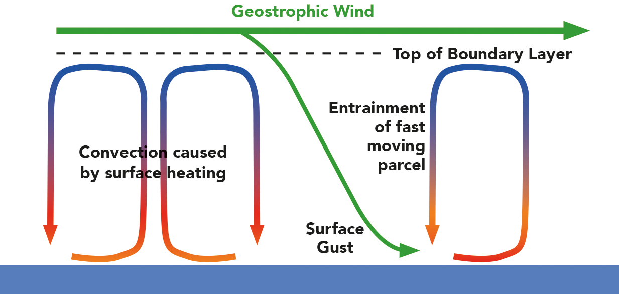
The entrainment of a geostrophic wind air parcel to become a surface gust
Looking at wind forecasts just above the boundary layer gives a good idea of the gusts, and the 925hPa level (700-800m up) is useful for this and easily available as GRIB data. These two charts show this, with 12 hours difference taking the wind from 24 gusting 31kts (fresh, but still OK for spinnakers given the right equipment and crew) to 26 gusting 43kts (almost certainly not OK for spinnakers!).
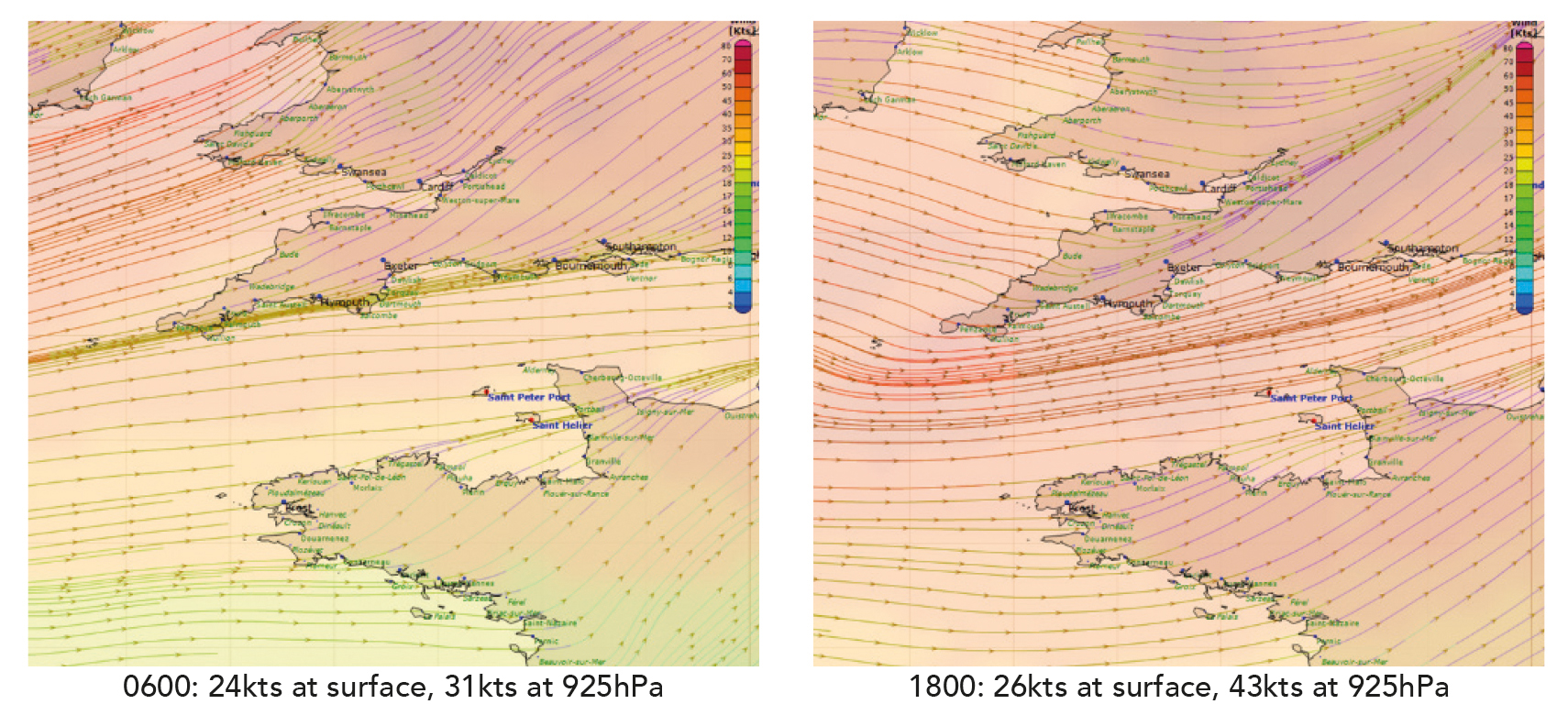
Surface wind streamlines and 925hPa wind speed (shading) 12 hours apart in the English Channel: ahead of what looks like a front coming in (note the veering wind at the 1800 plot) the surface wind is only a little stronger, but it’s now gusting to 43kts, Beaufort Force 9
One thing to note – the 925hPa wind usually comes from the right of the surface wind in the Northern Hemisphere, and to the left in the Southern. However, by the time the parcels of fast moving air make it to the surface the chaos of the boundary layer will mean that the gusts are almost always evenly distributed either side of the mean surface wind direction.
© Not to be reproduced without written permission from Fernhurst Books Limited.
Weather At Sea is written by Simon Rowell. Simon Rowell is a world-class weather forecaster and yachting professional. He has skippered a yacht to victory in the Clipper Round the World Race and has been forecaster for that race since 2011. Since 2015 he has been the meteorologist for the British Olympic Sailing Team.
To get more top tips from Simon, Weather at Sea can be bought here