Wind Preparation: At The Regatta
Book Extract
The availability, accessibility and accuracy of weather information has changed enormously since the first edition of Wind Strategy was published, but the following statement still holds true:
There is nothing mystical or magical about weather routeing. It is simply making sure that at every stage of a race, however long or short:
- You have not overlooked any available and relevant weather information.
- You have used this information to find the quickest way to the finish.
The key word here is ‘relevant’. There is little point in being able to download megabytes of fancy weather charts for a two-hour harbour race in a dinghy. You need to know the weather forecast, the tides and currents, and how the wind behaves around the bay using the techniques described in earlier chapters.
On a dinghy course you have to do your own weather routeing. Starting with the best and latest weather observations and forecasts, you think through how the shape and topography of the coast and variations in water temperature are likely to influence the winds experienced on the first beat to windward. At the same time, observing the minute-by-minute evolution of the wind and weather, you operate like an onboard computer, judging at every stage of the race which is the best way to go.
The same applies in a typical inshore or short offshore race. You will always have a better appreciation than anyone onshore of what the wind is doing in the short term, particularly the bends, bands and eddies which you must then apply to the latest forecast. And the more you appreciate and understand the ways of the wind within the frameworks presented in the preceding chapters, the better your judgement will be.
Any system of routeing can only be as good as the information available in the first place, and we can all suffer from false confidence in the software. But there will always be uncertainties and someone, somewhere has to decide.

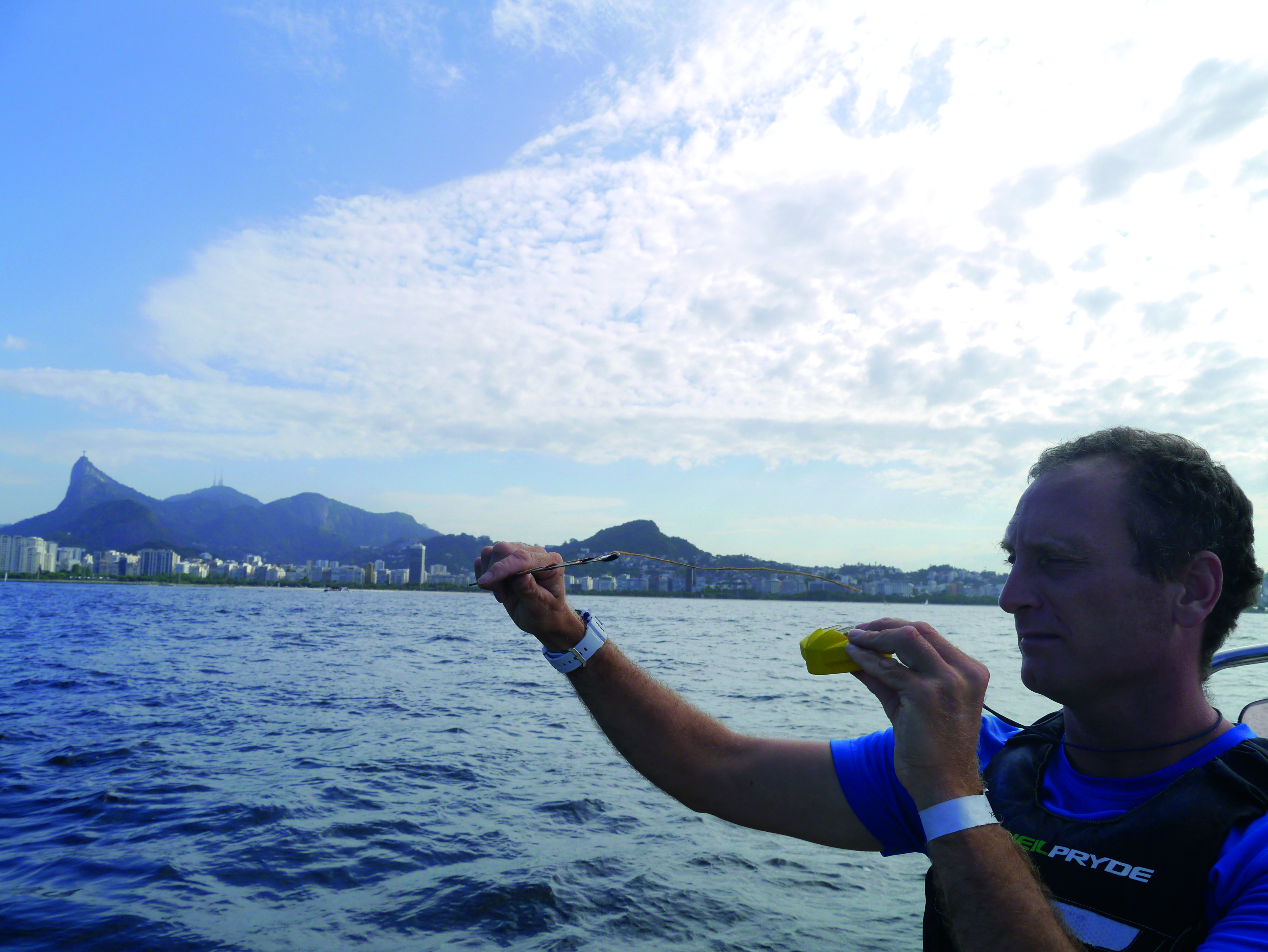
Observing the weather in Rio in preparation for the 2016 Olympic Games
How To Make The Weather Forecast Useful
It is not unusual to hear a frustrated helmsman blame the forecast for a poor position, and indeed there is no better scapegoat. And you are right to ask whether a standard forecast or even a specialist forecast for a race area is of much help. Occasionally, of course, it will be dead right and there will be someone who has believed it and won. But what about on average?
The weather forecast is a vital piece of information for every sailor in every regatta. Its value lies in the background information which it provides: information which will enable you to judge the likelihood, position and character of bends, bands and shifts in the wind. In fact you cannot apply the information from Chapters 2 to 19 unless you know the direction and strength of the gradient wind and how it is expected to change – information that is the basic ingredient of every forecast. But beware of treating a forecast as though it is ‘ready for immediate use’.
The weather is often an overlooked or only partially-studied aspect of sailing, it being assumed that it is either too unpredictable to allow one sailor to use it consistently to advantage over another or that an app can give the exact minute-by-minute answer. But with practice, the weather, deduced from the theoretical tools in this book added to the observations and forecast, could prove to be that added extra which puts you ahead of the rest.
The Importance Of Your Own Observations
It is always amazing how many sailors either rely on what they are told and ignore what they can see for themselves, or rely on what they can see happening before a regatta and ignore the forecast and the indications of change. Your own observation is a piece in the weather jigsaw, which is likely to be unique to you. Your observations are weather facts, and every forecast is based on the facts about the weather at the time it was written. Never reject either the forecast or the observation. The more you practice putting them together the better your judgement in a race will be.
Where To Get Weather Information
Most sailors rely on the internet for weather information and the sources are endless. Website addresses are too numerous and constantly changing to be listed in this book, but a general search for weather in your local sailing area should produce plenty of choices to select from. Local sailing club and event websites often have useful links.
Spot location forecasts which detail the wind speed and direction as frequently as 20 or 30 minutes appear to give the sailor what they want: ‘the weather answer’. But it’s all too easy to rely on this detail and not think through the complications and race course specifics which are not in the forecast. Instead:
- Try to use two or three sites and build up the overall race period picture.
- Use methods described here, such as drawing the race area on a chart and highlighting the likely wind effects.
- Rain radar imagery is becoming increasingly useful with the availability of high frequency images at high resolution. This will allow you to check, when ashore, where the rain is and compare it to the forecast to make sure things are roughly on track.
- Sea surface temperatures and air temperature information is freely available to add detail to a forecast of sea breeze or thermal enhancement.
The internet also provides a wealth of information which can be gathered before travelling to a venue: previous race reports with frequent comments about the weather and tactics, and summarised weather data for various times of the year help to build an overall impression of the climate. Use videos, maps, satellite images and photos to build a picture of the area: where are the topographic features in relation to the race course in different wind directions? How high and rough are they? Where will the wind bends and bands be? When will water be flat or rough? These will allow the sailor to build an overall impression of a venue before even leaving home. A little homework by visiting sailors can greatly reduce the ‘home advantage’.
During The Previous Few Days
Follow The Weather On The Scale Of The Weather Map
Note the movements of depressions, fronts, troughs, anticyclones and ridges from day to day. Get a feel for how fast things are developing and for the way the pressure gradient wind is changing from day to day in both speed and direction. The internet is a useful tool in this respect as a video can be played which animates the charts and brings the weather to life.
Follow The Weather On The Small Scale
If you are preparing the boat near the regatta area, practice observing the clouds and the wind variations, getting a feel for the changes as they occur. Try to distinguish events that are due solely to changes in the gradient wind and those which are due to local factors. You can also do this from your desktop by comparing the forecast with local observations.
Study The Course
Think out the likely sea breezes for different gradient wind directions (a topographic or simple road map will help to give the local lay of the land: print and annotate this). Consider what effects the land will have on the wind if it is blowing offshore. Are there islands, bays and other features to influence the wind? What is the water temperature? Is it uniform? Are there any rivers, i.e. sources of fresh water, nearby? Look up the tides and the currents for the area.
Can Anything Be Gleaned From Satellite Pictures?
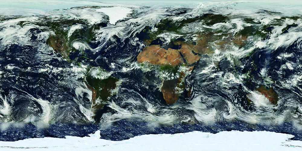
A copy of the latest picture from a weather satellite may be displayed or available on a smartphone. This helps to give credibility to the diagrammatic weather map; you can see for yourself that there are real swirls of cloud – depressions, and long, broad bands of cloud – fronts. But the pictures lack the resolution necessary to tell you anything useful about local cloud structures, while to deduce anything about their associated winds requires specialist expertise and a great deal of practice. So the answer is “no” – but they are nice to look at!

Although nice to look at, satellite images lack the resolution necessary to study local cloud structures
The Morning Of The Race
Ask yourself the following questions:
- What Is The Gradient Wind Doing?
- What is its direction? What is its speed? How will it be affected by local topographic and heating effects?
- What Is It Forecast To Do Over The Next Few Hours?
- Have you accessed the latest forecast and checked the observations upwind? Do they agree? Are changes expected and on what scale, i.e. is a front approaching or will local heating alter your sailing wind and at what time?
- How Are The Low Clouds Moving?
Take a compass bearing on their direction and judge their speed. Does their movement fit the forecast?
If it does not, then either mountains or valleys are interfering with it (see p51) or has the forecast been updated?

Take a compass bearing on their direction and judge their speed
What Is The Surface Wind At Present (i.e. early morning)?
Is it the remains of a night land breeze? Has it been killed by a night-time temperature inversion? Or does it agree with the gradient wind: 40 degrees or so back from it over land and much lighter early in the day? Details of land breezes and other local winds are not normally covered in a standard weather forecast.
What Wind Is Forecast Over The Water?
Does the forecast appear to have taken into account coastal influences on the wind? Look at a wide scale image of your area, not just a spot forecast.
Is The Wind Nearly Parallel To The Coast?
If it is, you must consider the divergence or convergence of streamlines.
Has The Gradient Wind An Offshore Component (i.e. is it in Quadrants 1 or 2)?
If it is less than 25 knots and cloud is thin or broken expect a sea breeze. If it is strong, or you are racing before or after the sea breeze, expect a bend or standing waves.
On The Water
Sailing To The Start
Observe and record the windshifts. Note any changes in cloud:
- Is the cloud dispersing just offshore? This suggests that a sea breeze is about to appear.
- Is the cloud generally increasing to weather? This suggests the approach of a trough.
- Is the cloud developing only over the land? This suggests a sea breeze building if the gradient wind is in Quadrant 1 or 2; other and possibly very different thermal influences if the gradient is in Quadrant 3 or 4.
On The First Beat
Does one side pay? If so is this due to:
- Features of the land or islands affecting the wind?
- The presence of a sea breeze?
- Water temperature variations across or upwind of the course?

First beat: Keep observing the weather up the first beat
If there is a good reason for one side paying, and you expect that feature of the wind or water to persist, go towards that side next time around. How far you should go towards the layline will depend on how certain you are that the bias is permanent. For instance, if there is an island upwind and no change in wind direction you can be confident that the bands of strong and light wind downwind from the island will continue. If you can find no good reason for the bias then go up the middle next time and play the shifts.
© Not to be reproduced without written permission from Fernhurst Books Limited.
Wind Strategy is written by weather experts and former Team GBR meteorologists David Houghton and Fiona Campbell. It has been the go-to weather book for racing sailors since 1986.